Home USA NE
KBFF

Western Nebraska Airport (BFF) | Terminal maps | Airport guide
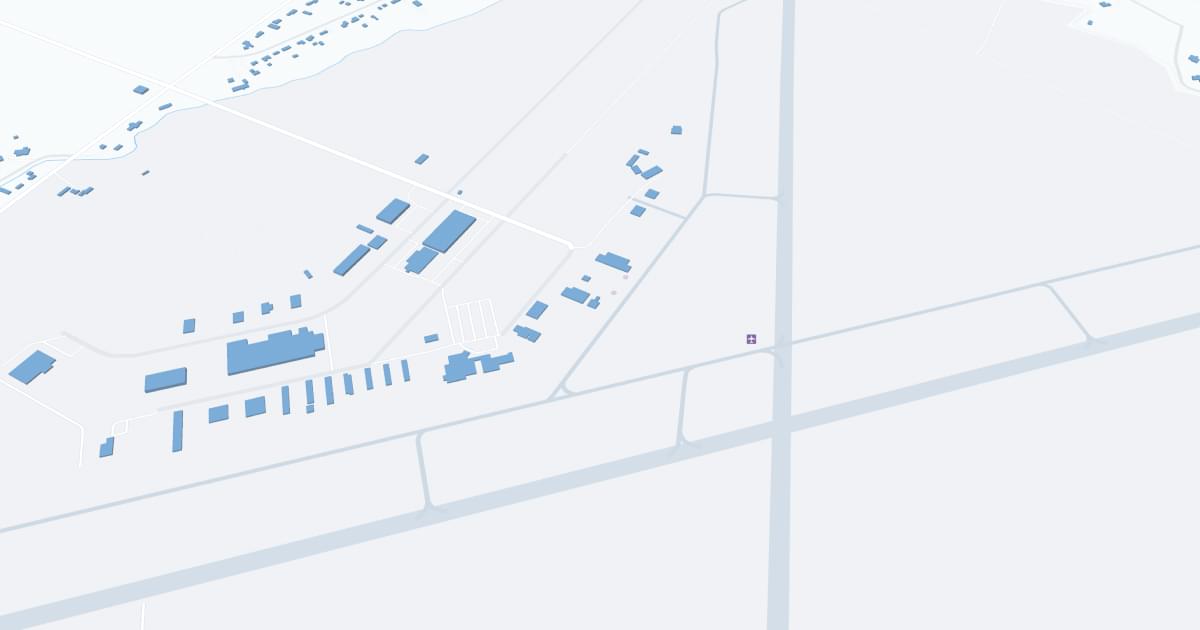
Western Nebraska Regional Airport-William B Heilig Field (BFF) Map
Scroll down for detailed airport maps and terminal information

About Western Nebraska Airport

Western Nebraska Regional Airport (BFF), located in Scottsbluff, Nebraska, serves as an essential gateway to the western part of the state. This regional airport features a single runway and a compact terminal, efficiently catering to both commercial and general aviation needs. BFF is served by United Express, operated by SkyWest Airlines, providing scheduled flights to Denver International Airport. This connection is crucial for local residents and businesses, offering access to national and international destinations. The terminal offers basic amenities including a waiting area, car rental services, and free parking. BFF plays a significant role in the regional transportation network, supporting local economic development and providing a vital link for the community of Scottsbluff and its surrounding areas.

Western Nebraska Airport Information

Airport Address:
250023 Airport Terminal St #10, Scottsbluff, NE 69361, United States
Official Website:
Contact Number:

BFF Manager Information

Manager:
RAUL AGUALLO
Address:
250023 AIRPORT TERMINAL ST., SUITE 10
Telephone:

Western Nebraska Airport Terminal Maps & Guides

BFF Airport Terminal

Western Nebraska Airport Parking

BFF - Parking

250023 Airport Terminal St #10, Scottsbluff, Nebraska 69361, United States, Scottsbluff

(308) 635-4941

Western Nebraska Airport Ground Transportation


BFF Airport Transit

Open Plains Transit

323 Flack Ave , Alliance , NE 69301

(308) 761-8747

BFF Airport Shuttle

KCTS Red Line

233 S Chestnut St , Kimball , NV 69145

(308) 235-0262

BFF Airport Taxi

Cabco

190632 Highway 26 , Scottsbluff , NE 69361

(308) 632-2224

BFF Airport Limo

Unique Unlimited LLC

(307) 365-4105

Info@uniqueunlimitedllc.com

Fly Rydes Transport

Scottsbluff , NE 69361

(308) 641-2222

flyrydestransport@gmail.com

Western Nebraska Airport Rental Cars

Hertz Rent A Car
Hours of Operation:
24 Hours, 7 Days a Week
Open For Final Arrival:
Yes

250023 Airport Rd, Scottsbluff

(308) 635-5555

Thrifty Rent A Car
Hours of Operation:
24 Hours, 7 Days a Week
Open For Final Arrival:
Yes

250023 Airport Rd, Scottsbluff

(308) 635-5555

Western Nebraska Airport Hotels

Monument Inn & Suites

Monument Inn & Suites is located in Gering, Nebraska, close to western Nebraska attractions such as Scotts Bluff National Monument, Chimney Rock, the Oregon Trail, and the Wildcat Hills Preserve.

Distance from Airport:
Distance from Airport 4.8 miles
Free Airport Shuttle:
No

1130 M St, NE, Gering, 69341

(308) 436-1950

Holiday Inn Express & Suites Scottsbluff-Gering, an IHG Hotel

Guests staying in Scottsbluff love our hotel's location because we are just three miles from the Scottsbluff County Airport. In addition, the Holiday Inn Express® Hotel & Suites Scottsbluff - Gering is in close proximity to numerous attractions, including Wild Life World. While they're staying in Scottsbluff, our hotel's business guests can take advantage of our business center, which offers print and copy services, as well as computer access. Nearby businesses include United Manufacturing Co. and Nebraska Business Development. The Gering Civic Center is also just five miles away.

Distance from Airport:
Distance from Airport 2.1 miles
Free Airport Shuttle:
No

1821 Frontage Rd, NE, Scottsbluff, 69361

(308) 632-1000

Candlelight Inn

The Candlelight Inn is owned and managed by Peg and Sid Henderson. The rooms are country-style bed and breakfast, with each room decorated a little differently. The building is two stories, with interior and exterior corridors.

Distance from Airport:
Distance from Airport 2.1 miles
Free Airport Shuttle:
Yes

1822 E 20th Place, NE, Scottsbluff, 69361-2707

(308) 635-3751

Airlines Serving Western Nebraska Airport

Western Nebraska Airport Routes and Destinations

Western Nebraska Airport Weather 11/21/2024

Weather Forecast
Sunny

Tonight

19

Mostly Clear

Sunny

Thursday

57

Sunny

Sunny

Thursday Night

26

Mostly Clear

Sunny

Friday

64

Sunny

Sunny

Friday Night

28

Partly Cloudy

Sunny

Saturday

60

Partly Sunny

Sunny

Saturday Night

31

Mostly Cloudy

Sunny

Sunday

47

Slight Chance Showers then Chance Rain/Snow

Sunny

Sunday Night

21

Chance Rain/Snow then Slight Chance Snow Showers

Sunny

Monday

39

Mostly Sunny

Sunny

Monday Night

18

Mostly Cloudy

Sunny

Tuesday

43

Mostly Sunny

Sunny

Tuesday Night

19

Slight Chance Snow Showers

BFF Airport Map and Directions


BFF Airport Diagram

BFF Charts & Navaids

Latitude:
37-37-07.7000N (37.618806)
Longitude:
122-22-31-5000W (-122.375417)
Elevation:
13.1 feet MSL (4 m MSL)
Magnetic Variation:
13.2 E (as of March 2022 from WMM2020 model)
Time Zone:
UTC -8.0 (Standard Time)
UTC -7.0 (Daylight Savings Time)
From City:
08 N.M. SE of San Francisco, California
Found On:
San Francisco Chart
FAA Region:
AWP
Close
press and move the map