Home USA MI
KCIU

Chippewa County Airport (CIU) | Terminal maps | Airport guide
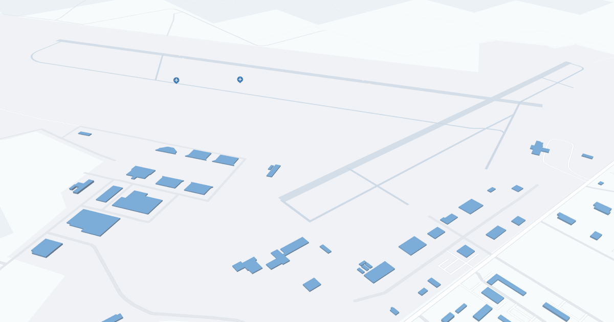
Chippewa County International Airport (CIU) Map
Scroll down for detailed airport maps and terminal information

About Chippewa County Airport

Chippewa County International Airport (CIU), located in the Upper Peninsula of Michigan, serves as a key transportation hub for the region. Positioned approximately 20 miles south of Sault Ste. Marie, it offers convenient access to both local communities and tourist destinations like the Great Lakes. CIU is primarily served by Delta Air Lines, providing daily flights to Detroit Metropolitan Airport. This connection enables travelers to access a wide network of national and international flights. The airport features a small, efficiently designed terminal, ensuring a quick and hassle-free travel experience. Amenities at CIU are basic but adequate, including car rental services and a comfortable waiting area. Its strategic location and essential services make Chippewa County International Airport a vital gateway to Michigan's scenic Upper Peninsula.

Chippewa County Airport Information

Airport Address:
5315 W Airport Dr, Kincheloe, MI 49788, United States
Official Website:
Contact Number:

CIU Manager Information

Manager:
TAMI L BESEAU
Address:
5019 W AIRPORT DR
Telephone:

Chippewa County Airport Terminal Maps & Guides

CIU Airport Terminal

Chippewa County Airport Parking

CIU - Parking

5315 W Airport Dr, Kincheloe, MI 49788, United States, Kincheloe

(906) 495-5631

Chippewa County Airport Ground Transportation


CIU Airport Shuttle

Northern Transport & Shuttle

188 Fitch St , Saint Ignace , MI 49781

(906) 430-5337

CIU Airport Taxi

Driverseat

Kincheloe , MI 49788

(249) 493-6444

CIU Airport Limo

Soo Line Limousine

3303 I-75 Business Spur , Sault Ste Marie , MI 49783

(906) 635-0427 ,(906) 440-5161

Chippewa County Airport Rental Cars

Enterprise Rent A Car
Hours of Operation:
24 Hours, 7 Days a Week
Open For Final Arrival:
Yes

5315 W Airport Dr Kincheloe, Kincheloe

(906) 495-1035

Chippewa County Airport Hotels

Budget Host-Crestview Inn

The Crestview Inn Motel is located on the I-75 Business Spur in the hart of Sault Ste. Marie Michigan. Here you are in the middle of all the Soo has to offer. Great Casinos, the Soo Locks and the St Marys River, shops, dining, championship golf, ATV and snowmobile trails.

Distance from Airport:
Distance from Airport 15.5 miles
Free Airport Shuttle:
No

1200 Ashmun Street, MI, Sault Ste. Marie, 49783

(906) 635-5213

BEST WESTERN Sault Ste. Marie

This Upper Peninsula Michigan hotel, with convenient access to I- 75, offers comfortable accommodations for travelers to historic Sault Ste. Marie.

Distance from Airport:
Distance from Airport 15.0 miles
Free Airport Shuttle:
No

4335 I-75 Business Spur, MI, Sault Ste. Marie, 49783-3621

(906) 632-2170

Plaza Motor Motel

A hybrid of sorts. We are an intimate-sized property with 21 finely appointed guest rooms one would more likely find in a country inn or bed and breakfast but we have the convenience and price point of a traditional park-at-your-door style motel.

Distance from Airport:
Distance from Airport 15.0 miles
Free Airport Shuttle:
No

3901 I 75 Business Spur, MI, Sault Ste. Marie, 49783

(906) 635-1881

Airlines Serving Chippewa County Airport

Chippewa County Airport Routes and Destinations

Chippewa County Airport Weather 11/21/2024

Weather Forecast
Sunny

Overnight

37

Rain

Sunny

Thursday

43

Scattered Showers

Sunny

Thursday Night

39

Slight Chance Showers

Sunny

Friday

46

Slight Chance Showers then Chance Showers

Sunny

Friday Night

35

Showers Likely

Sunny

Saturday

41

Showers Likely

Sunny

Saturday Night

29

Mostly Cloudy

Sunny

Sunday

40

Mostly Cloudy then Chance Showers

Sunny

Sunday Night

29

Chance Showers then Chance Rain/Snow

Sunny

Monday

40

Showers Likely

Sunny

Monday Night

26

Showers Likely then Rain/Snow Likely

Sunny

Tuesday

35

Chance Rain/Snow

Sunny

Tuesday Night

23

Chance Snow Showers

CIU Airport Map and Directions


CIU Airport Diagram

CIU Charts & Navaids

Latitude:
37-37-07.7000N (37.618806)
Longitude:
122-22-31-5000W (-122.375417)
Elevation:
13.1 feet MSL (4 m MSL)
Magnetic Variation:
13.2 E (as of March 2022 from WMM2020 model)
Time Zone:
UTC -8.0 (Standard Time)
UTC -7.0 (Daylight Savings Time)
From City:
08 N.M. SE of San Francisco, California
Found On:
San Francisco Chart
FAA Region:
AWP
Close
press and move the map