Home USA SD
KHON

Huron Airport (HON) | Terminal maps | Airport guide
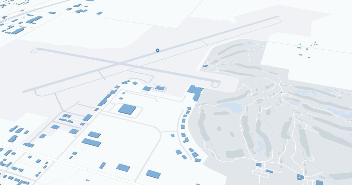
Huron Regional Airport (HON) Map
Scroll down for detailed airport maps and terminal information

About Huron Airport

Huron Regional Airport (HON), located in Huron, South Dakota, is a key air link for the local and surrounding communities. It is served by Denver Air Connection, which offers direct flights to Denver, facilitating connections to larger national and international networks. The airport terminal is equipped with all the necessary amenities, including convenient parking, car rental services for exploring the region, and cabs for local transportation. The significance of HON Airport lies in its role in supporting regional economic development by providing a vital link for business, healthcare and tourism, thereby enhancing the quality of life and accessibility for residents and visitors.

Huron Airport Information

Airport Address:
426 15th St NW, Huron, SD 57350, United States
Contact Number:

HON Manager Information

Manager:
LARRY COOPER
Address:
PO BOX 1369
Telephone:

Huron Airport Terminal Maps & Guides

HON Airport Terminal

Huron Airport Parking

HON - Parking

426 15th St NW, Huron, SD 57350, United States, Huron

(605) 353-8516

Huron Airport Ground Transportation


HON Airport Taxi

Fair City Taxi Co. LLC

460 Dakota Ave S, Ste 2 , Huron , SD 57350

(605) 663-9999

H&S Taxi Service

1056 Frank Ave SE , Huron , SD 57350

(605) 350-7430

Huron Airport Hotels

Dakota Inn

When you need great rooms at great rates, stay at Dakota Inn in Huron, South Dakota! Choose Dakota Inn when you need to stay in the Huron area. We offer great rooms and suites, plus our great location makes access easy to wherever you're going.

Distance from Airport:
Distance from Airport 2.2 miles
Free Airport Shuttle:
No

924 4th St NE, SD, Huron, 57350-2654

(605) 352-1400

Super 8 Huron

Value meets convenience at our Super 8 Huron hotel. With an ideal location on U.S. Highway 37, our hotel gives you quick access to the most popular attractions and recreational activities in the region, including golfing, fishing, and hunting.

Distance from Airport:
Distance from Airport 3.8 miles
Free Airport Shuttle:
No

2189 Dakota Ave S, SD, Huron, 57350

(605) 352-0740

Best Western Of Huron

This gem on the prairie is also great for family vacations. Guests of the BEST WESTERN Of Huron delight in the fact that South Dakota State Fair Grounds, World's Largest Pheasant and Pyle House, Laura Ingalls Wilder Museum and Pagent and Kaspersons Southside Huron are all within an hour of this Huron, SD hotel. Guests can also enjoy just a short drive to many other local attractions, such as the Broadland Creek Golf Course and Lake Byron. The clean, charming rooms at this South Dakota Best Western offer free high-speed Internet access, cable satellite television, a coffeemaker, a microwave, a refrigerator and much more. Get a great start to each day at this Huron, SD hotel with a complimentary continental breakfast.

Distance from Airport:
Distance from Airport 3.5 miles
Free Airport Shuttle:
No

2000 Dakota Ave S, SD, Huron, 57350-4027

(605) 352-2000

Huron Airport Routes and Destinations

Huron Airport Weather 11/21/2024

Weather Forecast
Sunny

Overnight

19

Partly Cloudy and Blustery

Sunny

Thursday

34

Mostly Sunny

Sunny

Thursday Night

16

Mostly Clear

Sunny

Friday

39

Mostly Sunny

Sunny

Friday Night

21

Partly Cloudy

Sunny

Saturday

43

Partly Sunny

Sunny

Saturday Night

24

Mostly Cloudy

Sunny

Sunday

37

Partly Sunny

Sunny

Sunday Night

15

Mostly Cloudy

Sunny

Monday

29

Mostly Sunny

Sunny

Monday Night

12

Partly Cloudy

Sunny

Tuesday

33

Mostly Sunny

Sunny

Tuesday Night

13

Partly Cloudy

HON Airport Map and Directions


HON Airport Diagram

HON Charts & Navaids

Latitude:
37-37-07.7000N (37.618806)
Longitude:
122-22-31-5000W (-122.375417)
Elevation:
13.1 feet MSL (4 m MSL)
Magnetic Variation:
13.2 E (as of March 2022 from WMM2020 model)
Time Zone:
UTC -8.0 (Standard Time)
UTC -7.0 (Daylight Savings Time)
From City:
08 N.M. SE of San Francisco, California
Found On:
San Francisco Chart
FAA Region:
AWP
Close
press and move the map