Home USA MT
KOLF

L M Clayton Airport (OLF) | Terminal maps | Airport guide
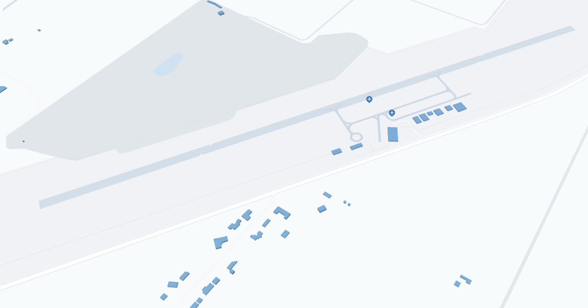
L M Clayton Airport (OLF) Map
Scroll down for detailed airport maps and terminal information

About L M Clayton Airport

L. M. Clayton (OLF), located in Wolf Point, Montana, serves as an important air link for the northeastern part of the state, including the Fort Peck Indian Reservation. 

OLF Airport serves primarily general aviation, with Cape Air offering direct flights to Billings. This connectivity provides passengers with access to major national and international networks, facilitating travel for both business and leisure.

The airport has basic amenities such as parking and nearby car rental services, making regional exploration convenient for travelers. 

The L.M. Clayton Airport plays an important role for the local community by providing connections to outlying areas, supporting regional economic development, and providing vital transportation services that contribute to the accessibility and growth of Wolf Point and surrounding areas.

L M Clayton Airport Information

Airport Address:
7057 Montana 25, Wolf Point, Mt 59201, United States
Contact Number:

OLF Manager Information

Manager:
ED BACH
Address:
WOLF POINT AIRPORT, 201 4TH AVE SOUTH
Telephone:

L M Clayton Airport Terminal Maps & Guides

OLF Airport Terminal

L M Clayton Airport Ground Transportation


OLF Airport Shuttle

Shuttle Me Transportation Service

200 Terminal Dr , New Bern , NC 28560

(252) 637-7433

L M Clayton Airport Rental Cars

High Plains Motors, Inc.
Hours of Operation:
24 Hours, 7 Days a Week
Open For Final Arrival:
Yes

331 Front Street, Wolf Point

(406) 653-1244

L M Clayton Airport Hotels

The Jolly Swagman Inn

Welcome to The Jolly Swagman Inn located in Poplar, Montana along Highway 2. Native-American- and Australian-owned, the inn is open year round and offers rooms for long & short stays in a variety of configurations.

Distance from Airport:
Distance from Airport 18.0 miles
Free Airport Shuttle:
No

150 F Street West, MT, Poplar, 59255

(406) 768-3287

Big Sky Motel

The Big Sky Motel, located just off of Interstate 90, Exit 47, in Superior, Montana, welcomes all to our hospitality and the splendor of our picturesque setting located in the Rocky Mountains. For today's traveler we offer 'rates you can sleep with' in a quality AAA rated facility. Whether you are a single traveler or a family you will find the comforts of home including remote control TVs, quality beds, individual heating and air conditioning and high speed Internet access. Our cheery staff is eagerly waiting to serve you from check-in to your continental breakfast. Our guests rate us tops from friendliness to cleanliness. Pets are allowed in designated rooms, additional fees apply.

Distance from Airport:
Distance from Airport 3.0 miles
Free Airport Shuttle:
No

US Highway 2 E, MT, Wolf Point, 59201

(406) 653-2300

Sherman Inn Wolf Point

The Sherman Inn located in Wolf Point, Montana on HWY US 2, "The shortest route across Montana to Glacier Park", welcomes you to stay at the finest lodging and convention center that eastern Montana has to offer. Enjoy the hospitality for a great Montana Getaway. Our friendly staff invites you to enjoy one of our 46 rooms, dine in our family dining room or relax in the lounge and casino.

Distance from Airport:
Distance from Airport 2.9 miles
Free Airport Shuttle:
No

200 E. Main, MT, Wolf Point, 59201

(406) 653-1100

Airlines Serving L M Clayton Airport

L M Clayton Airport Routes and Destinations

L M Clayton Airport Weather 11/21/2024

Weather Forecast
Sunny

Tonight

10

Partly Cloudy

Sunny

Thursday

34

Partly Sunny

Sunny

Thursday Night

14

Slight Chance Snow

Sunny

Friday

31

Chance Snow

Sunny

Friday Night

15

Snow Likely

Sunny

Saturday

33

Snow Likely

Sunny

Saturday Night

8

Snow Likely

Sunny

Sunday

21

Chance Snow

Sunny

Sunday Night

-1

Mostly Cloudy

Sunny

Monday

20

Mostly Sunny

Sunny

Monday Night

-1

Mostly Cloudy

Sunny

Tuesday

24

Partly Sunny

Sunny

Tuesday Night

2

Mostly Cloudy

OLF Airport Map and Directions


OLF Airport Diagram

OLF Charts & Navaids

Latitude:
37-37-07.7000N (37.618806)
Longitude:
122-22-31-5000W (-122.375417)
Elevation:
13.1 feet MSL (4 m MSL)
Magnetic Variation:
13.2 E (as of March 2022 from WMM2020 model)
Time Zone:
UTC -8.0 (Standard Time)
UTC -7.0 (Daylight Savings Time)
From City:
08 N.M. SE of San Francisco, California
Found On:
San Francisco Chart
FAA Region:
AWP
Close
press and move the map