Home USA AZ
KSOW

Show Low Airport (SOW) | Terminal maps | Airport guide
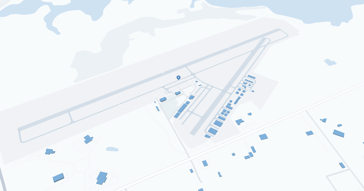
Show Low Regional Airport (SOW) Map
Scroll down for detailed airport maps and terminal information

About Show Low Airport

Shaw Lowe Regional Airport (SOW), located in Arizona's White Mountains, serves as a critical link to the scenic landscapes and recreational destinations of northeastern Arizona. 

The airport is primarily served by Boutique Air, offering direct flights to Phoenix, from where passengers can access a wider network of national and international destinations. This connection is critical to local businesses, tourism and residents, contributing to the economic growth and affordability of the region. 

Shaw Lowe Airport amenities include parking, car rental and cab services, enhancing the visitor's travel experience. 

The Shaw Lowe Regional Airport plays a critical role in promoting the region's natural attractions and supporting community connectivity and development.

Show Low Airport Information

Airport Address:
3150 Airport Loop Rd, Show Low, AZ 85901, United States
Contact Number:

SOW Manager Information

Manager:
TOM BAHR
Address:
3150 AIRPORT LOOP, #100
Telephone:

Show Low Airport Terminal Maps & Guides

SOW Airport Terminal

Show Low Airport Parking

SOW - Parking

3150 Airport Loop Rd #100, Show Low, AZ 85901, United States, Show Low

(928) 532-4190

Show Low Airport Ground Transportation


SOW Airport Shuttle

Mountain Valley Shuttle

1141 E Cooley St Ste B , Show Low , AZ 85901

(928) 537-4539

SOW Airport Taxi

Desert Rides Cab Service

Show Low , AZ 85901

(928) 313-4890

AZ JAM N

Show Low , AZ 85901

(928) 940-2246

azjamnllc@gmail.com

Saferide & Delivery

6310 Crimson Oak Dr , Pinetop-Lakeside , AZ 85929

(928) 368-3573

Show Low Airport Rental Cars

Enterprise Rent-A-Car
Hours of Operation:
24 Hours, 7 Days a Week
Open For Final Arrival:
Yes

980 East Deuce of Clubs, Show Low

Show Low Airport Hotels

Best Western Paint Pony Lodge

The warm and friendly staff of the BEST WESTERN Paint Pony Lodge strives to make every guest's stay as comfortable as possible! A complimentary hot breakfast is served every morning in the spacious lobby by a cozy fireplace. Every afternoon, the hotel serves complimentary home made cookies and fresh brewed coffee for guests. Each room is equipped with free high-speed Internet, a microwave, refrigerator and cable television with HBO®. Deluxe Honeymoon and Presidential Suites are available.

Distance from Airport:
Distance from Airport 2.8 miles
Free Airport Shuttle:
Yes

581 West Deuce of Clubs, AZ, Show Low, 85901-5813

(928) 537-5773

Days Inn Show Low

Days Inn Show Low, Arizona is nestled in the heart of the beautiful White Mountains of Arizona. The Days Inn Show Low is a wonderful place to relax and enjoy the scenery. Whether you are on business or enjoying one of the many outdoor activities such as fishing, hunting, hiking, skiing, sightseeing, or one of our beautiful golf courses. Relax by the Heated Outdoor swimming pool and enjoy a hearty meal from JBs Family Restaurant.

Distance from Airport:
Distance from Airport 2.7 miles
Free Airport Shuttle:
Yes

480 West Deuce of Clubs, AZ, Show Low, 85901

(928) 537-4356

Hampton Inn & Suites Show Low-Pinetop

The Hampton Inn & Suites hotel in Show Low/Pine Top is located just south of Highway 60 and Highway 260, between downtown Show Low and Pine Top. The hotel is nestled high in the pines in the White Mountains of Arizona, with Show Low Creek running behind the hotel and overlooking a moss rock bluff topped with Ponderosa Pines.

Distance from Airport:
Distance from Airport 3.0 miles
Free Airport Shuttle:
No

1501 East Woolford Road, AZ, Show Low, 85901

(928) 532-4444

Airlines Serving Show Low Airport

Show Low Airport Routes and Destinations

Show Low Airport Weather 11/21/2024

Weather Forecast
Sunny

Tonight

23

Mostly Clear

Sunny

Thursday

62

Mostly Sunny

Sunny

Thursday Night

25

Mostly Clear

Sunny

Friday

65

Sunny

Sunny

Friday Night

32

Mostly Clear

Sunny

Saturday

65

Sunny

Sunny

Saturday Night

38

Mostly Clear

Sunny

Sunday

58

Partly Sunny and Breezy

Sunny

Sunday Night

37

Mostly Cloudy

Sunny

Monday

56

Mostly Cloudy

Sunny

Monday Night

36

Mostly Cloudy

Sunny

Tuesday

57

Partly Sunny

Sunny

Tuesday Night

35

Slight Chance Showers

SOW Airport Map and Directions


SOW Airport Diagram

SOW Charts & Navaids

Latitude:
37-37-07.7000N (37.618806)
Longitude:
122-22-31-5000W (-122.375417)
Elevation:
13.1 feet MSL (4 m MSL)
Magnetic Variation:
13.2 E (as of March 2022 from WMM2020 model)
Time Zone:
UTC -8.0 (Standard Time)
UTC -7.0 (Daylight Savings Time)
From City:
08 N.M. SE of San Francisco, California
Found On:
San Francisco Chart
FAA Region:
AWP
Close
press and move the map