Home USA MO
KTBN

Waynesville St Robert Regional Airport (TBN) | Terminal maps | Airport guide
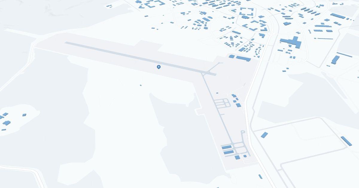
Waynesville-St Robert Regional Airport-Forney Field (TBN) Map
Scroll down for detailed airport maps and terminal information

About Waynesville St Robert Regional Airport

Waynesville-St. Robert-Forney Field Regional Airport (TBN), located adjacent to Fort Leonard Wood, Missouri, is the most important airport serving military personnel, their families and civilians in the south-central Missouri region. 

TBN primarily offers Contour Airlines flights to St. Louis and provides convenient connections to national and international destinations. This accessibility is critical to the military base and the local community, providing for both active duty and personal travel. 

The airport has parking, car rental and cab services to meet the needs of travelers. 

TBN plays an important role in the region's transportation links, promoting local tourism and providing connections to the broader transportation networks.

Waynesville St Robert Regional Airport Information

Airport Address:
5017 Iowa Ave, Fort Leonard Wood, MO 65473
Official Website:
Contact Number:

TBN Manager Information

Manager:
MIKE GUY
Address:
FORNEY ARMY AIRFIELD
Telephone:

Waynesville St Robert Regional Airport Terminal Maps & Guides

TBN Airport Terminal

Waynesville St Robert Regional Airport Parking

TBN - Parking

5017 Iowa Ave, Fort Leonard Wood, MO 65473, United States, Fort Leonard Wood

(888) 332-6686

Waynesville St Robert Regional Airport Ground Transportation


TBN Airport Shuttle

STL Shuttle Service

PO BOX 300 , Pevely , MO 63070

(314) 450-6453

stlshuttleservice@gmail.com

USA Express

(800) 872-9399

TBN Airport Taxi

Fort Cab

931 Missouri Ave , St Robert , MO 65584

(573) 336-2996

Union Cab

15275 Texas Rd , St Robert , MO 65584

(573) 336-1111

unioncabcompany@gmail.com

Show Me Cab

500 Hwy Y , St Robert , MO 65584

(573) 336-4455

showmecab@gmail.com

Waynesville St Robert Regional Airport Rental Cars

Enterprise Rent A Car
Hours of Operation:
24 Hours, 7 Days a Week
Open For Final Arrival:
Yes

208 Old Rt 66, Saint Robert

(573) 336-7355

Waynesville St Robert Regional Airport Hotels

MainStay Suites St. Robert - Fort Leonard Wood

This distinctive four-story extended-stay hotel has 77 Suites in the St. Robert/Fort Leonard Wood area. We are the "home away from home". For business travelers, the comfortable place for those just passing through, the home to Fort Leonard Wood's finest attending schools and the perfect place for families here for graduation. We are located 3 miles from Fort Wood's main entrance.

Distance from Airport:
Distance from Airport 5.9 miles
Free Airport Shuttle:
No

227 St Robert Blvd, MO, Saint Robert, 65584

(573) 232-1729

Best Western Montis Inn

Enjoy an array of amenities and convenient access to the Fort Leonard Wood Military Base and the Lake of the Ozarks while staying at this Saint Robert, Missouri hotel. Whether traveling on business or pleasure, the Best Western Montis Inn offers the highest standard of accommodations and customer service at an affordable price to ensure an enjoyable stay for every guest.

Distance from Airport:
Distance from Airport 6.8 miles
Free Airport Shuttle:
No

14086 Highway Z, MO, Saint Robert, 65584-3272

(573) 336-4299

Studio Z, Ascend Hotel Collection

Let the destination reach you at the pet-friendly Studio Z Extended Stay Hotel & Lounge, Ascend Hotel Collection® in St. Robert. Located on Historic Route 66 in the heart of Pulaski County, our hotel is just three miles to US Army Fort Leonard Wood. You’ll enjoy amenities that make your stay truly special. Connect to free WiFi throughout the hotel, enjoy free parking and take in free hot breakfast served each morning.

Distance from Airport:
Distance from Airport 5.6 miles
Free Airport Shuttle:
No

545 Highway Z, MO, Saint Robert, 65584

(573) 232-1610

Airlines Serving Waynesville St Robert Regional Airport

Waynesville St Robert Regional Airport Routes and Destinations

Waynesville St Robert Regional Airport Weather 11/21/2024

Weather Forecast
Sunny

Overnight

34

Clear

Sunny

Thursday

45

Sunny

Sunny

Thursday Night

28

Mostly Clear

Sunny

Friday

49

Sunny

Sunny

Friday Night

27

Mostly Clear

Sunny

Saturday

57

Sunny

Sunny

Saturday Night

41

Partly Cloudy

Sunny

Sunday

65

Mostly Sunny

Sunny

Sunday Night

44

Mostly Cloudy

Sunny

Monday

54

Partly Sunny

Sunny

Monday Night

29

Mostly Cloudy

Sunny

Tuesday

46

Partly Sunny

Sunny

Tuesday Night

28

Mostly Cloudy

TBN Airport Map and Directions


TBN Airport Diagram

TBN Charts & Navaids

Latitude:
37-37-07.7000N (37.618806)
Longitude:
122-22-31-5000W (-122.375417)
Elevation:
13.1 feet MSL (4 m MSL)
Magnetic Variation:
13.2 E (as of March 2022 from WMM2020 model)
Time Zone:
UTC -8.0 (Standard Time)
UTC -7.0 (Daylight Savings Time)
From City:
08 N.M. SE of San Francisco, California
Found On:
San Francisco Chart
FAA Region:
AWP
Close
press and move the map